Department of Emergency Support
Over the past few years, the Department of Emergency Support has implemented an internal UAS unit qualifying as professional Operator for operations both in the Open and Specific category (EASA UAS Operator ID: ITAg2t1d4wftpivf).
The Drone Unit of EUCENTRE is composed of a fleet of different types of vehicles, pilots and trained professionals able to operate in different scenarios (both standard and critical) foreseen by the national and European legislative framework, with specialization in data analysis, structures, tanks, monitoring, in-situ testing and post-emergency technical support. Drones (also known as UAS) equipped with
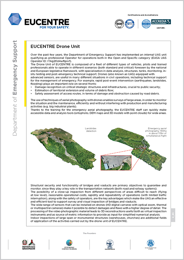
advanced sensors, are useful in many different situations in civil operations, including technical support for the management of emergency. For example, rapid post-event intervention (earthquakes, landslides, flooding) plays an important role on several fronts:
- Damage recognition on critical strategic structures and infrastructures, crucial to public security;
- Estimation of territorial extension and volume of debris flow;
- Safety assessment of access routes, in terms of damage and obstruction caused by road debris.
The use of techniques of aerial photography with drones enables surveys of large areas, in order to monitor the situation and the maintenance, efficiently and without interfering with production and manufacturing activities (e.g. big industrial plants).
Thanks to the training for the emergency aerial photography, the EUCENTRE staff can quickly make accessible data and analysis tools (ortophoto, DEM maps and 3D models with point clouds) for wide areas.

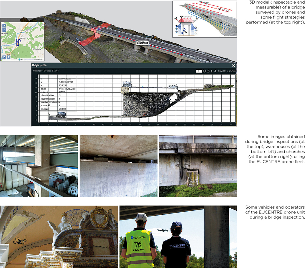
Structural security and functionality of bridges and viaducts are primary objectives to guarantee and monitor, since they play a key role in the transportation network (both road and railway systems).
The possibility of a close-up inspection from different perspectives of areas difficult to reach (flying at low level), reasonable operational costs, rapidity and repeatability of operations (with limited traffic interruption), along with the safety of operators, are the key advantages which make the UAS an effective and efficient tool to support survey and visual inspection of bridges and viaducts.
The wide range of sensors that can be installed on drones (HD digital cameras with optical zoom, thermal or multispectral cameras) make it possible to detect damages and flaws with a higher degree of detail. The processing of the video photographic material leads to 3D reconstructions useful both as virtual inspection instruments and as source of metric information to provide as input for simplified numerical analysis.
Indoor inspections of large span or monumental structures (warehouses, churches) are additional fields of application of the activities carried out by the drone unit of EUCENTRE.
Services, Research and Development Activities
The services provided by the drone unit combine the inspection and survey activities with specialized support carried out in close collaboration with the Risk Scenarios and Construction and Infrastructure Departments.
- Emergency Support services:
· Inspections for the post-event assessment of bridges and infrastructures;
· Surveys for the post-event rapid assessment of the cultural heritage;
· Aerial photography of emergency (mapping of affected areas, evaluation of access, prevention of secondary effects, estimation of the total volume of debris, etc.);
· Networking in connection with the activities of the Centers of Competence of the Department of Civil Protection.
· Support in the monitoring of structures and infrastructures (inspections, surveys and modelling):
· Bridges and viaducts;
· Large span buildings;
· Monuments. - Inspection activities in areas difficult to reach, with neither interruption of the activities of the inspected structure, nor danger for the safety of operators.
- Survey activities of medium-large areas and structures aimed at fast and personalized estimations.
- Collaborations in research and development projects aimed at improving structural safety:
· Standardization of inspection protocols;
· Integration of monitoring data from different sources (test in situ, satellite data, permanent monitoring, etc.);
· Use of artificial intelligence for the acknowledgement of damage.


